
In April I had the good fortune to attend the 2014 National APA (American Planning Association) Conference in Atlanta, Georgia with 5,000 fellow planners. Session topics ranged from autonomous cars and the Millennials to citizen participation and affordable housing. I’m still digesting all of the enlightening presentations and thought-provoking discussion, and here I’ve provided summaries that offer just a small glimpse into the challenges and opportunities planners will continue to face in the decades ahead. Feel free to scroll to topics, in bold, that interest you, because there’s a lot here. The conversations will be continued as the national conference is hosted in Seattle next year.
Atlanta
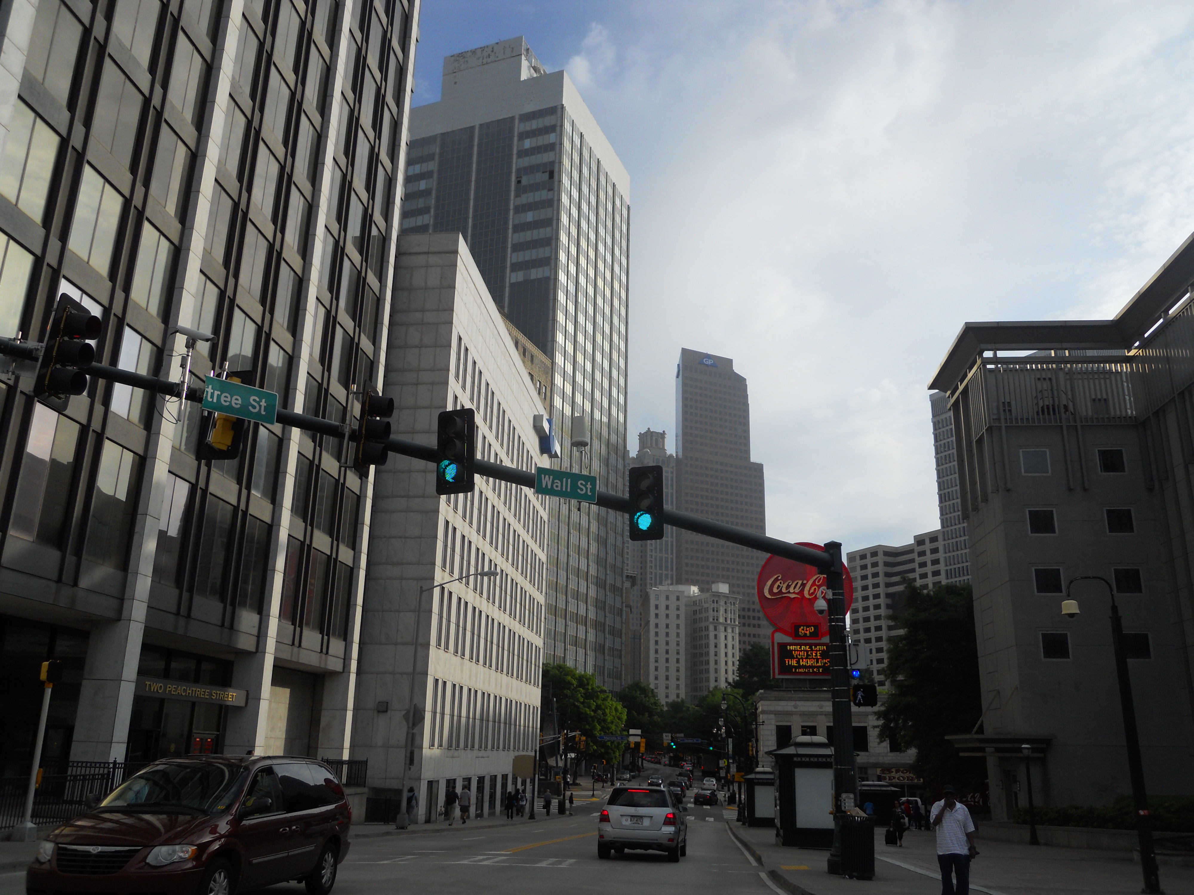
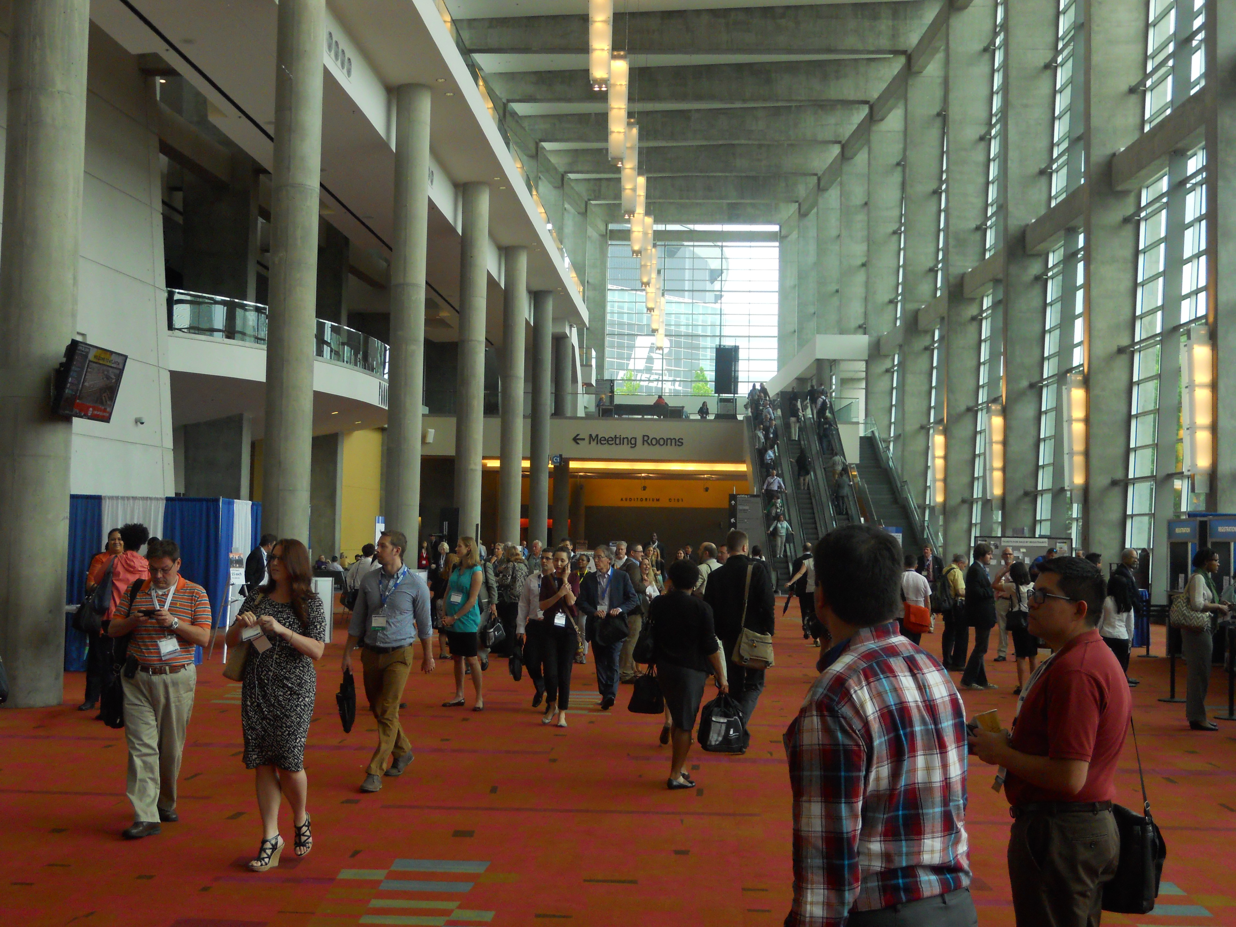
I had only passed through Atlanta once, on the way to Savannah, so I was happy for a reason to stay and explore this world-renown city. I stayed in the heart of the city, the Midtown neighborhood, which excellent access to transit and walkable shopping and eating destinations. I didn’t get a chance to check out major attractions, such as the Fox Theater and Georgia Aquarium, but got a good sense of the city’s core and what it has to offer for people of all ages and lifestyles. This quality extends into the city’s variety of neighborhoods, but the rest of the metropolitan region is commonly ranked at the top of sprawl listings.
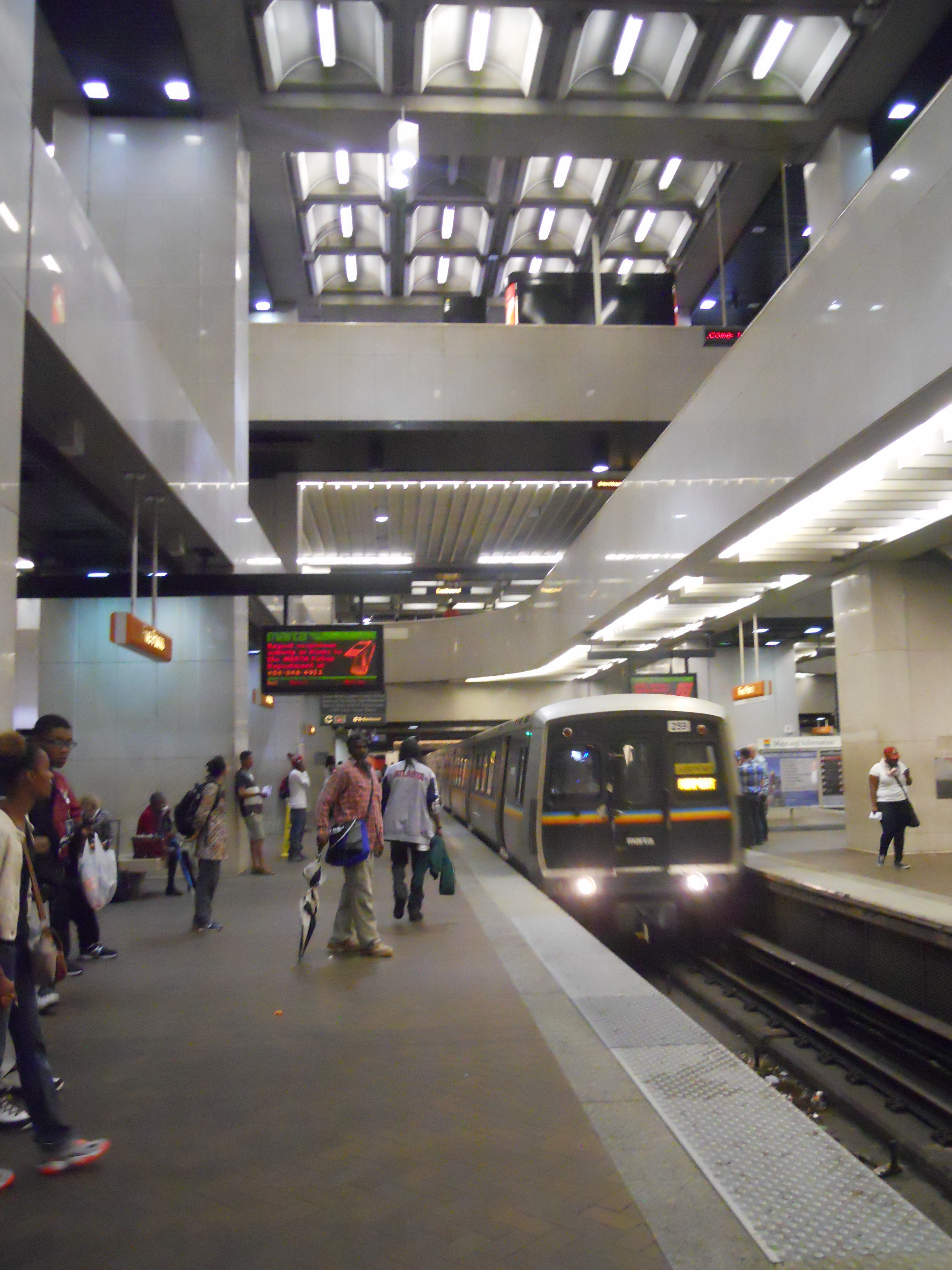
A MARTA train pulls in at Five Points station.
The region has a decent bus and subway system, with the rail construction funded by federal dollars that Seattle rejected in the late 1960s. None of the three or so rail stations near the Georgia World Congress Center (GWCC), where the conference was held, were particularly convenient. (The GWCC itself is massive, at 3.9 million square feet, and required walking long distances between events.) During my visit, crews were finishing testing on Atlanta’s first reborn streetcar line in downtown. But because of the transit system’s infrequent service and lack of service to some areas, I also got around by car in Atlanta. I used Zipcar to pickup a friend from the airport (the busiest in the world), and another friend used Lyft several times to get us to outlying neighborhoods and to Turner Field for a baseball game (the Braves beat Cinncinati 4-1!). I’ve since signed up for Lyft and used it in Seattle twice in the last week, and it’s much better than using a cab.
I didn’t get a chance to bike on the BeltLine, Atlanta’s major project that is attracting the attention of planners and developers alike, but I look forward to it next time I visit. Proposed in a graduate student’s thesis, the BeltLine effort is creating an “emerald necklace” of new and existing parks around the city connected by a 22 mile bike and pedestrian path on abandoned rail corridors. Though not yet complete, and with funding for an eventual streetcar line delayed, this public investment has already attracted over $1 billion in private development.
Autonomous Vehicles (AV)

The technology of driverless/self-driving cars presents a significant planning challenge. Despite advances in public transit ridership, 98 percent of motorized trips in the U.S. are made by car. Transit will not be competitive in many cities for many years because land use arrangements are simply not conducive to walking, biking, or taking transit. This means autonomous vehicles are a big deal.
The National Highway Transportation Safety Administration lists five levels of vehicle automation:
0) No automation
1) Cruise control
2) Collision avoidance and lane-centering
3) “Texting machine”, hands off driving
4) No driver at all
Levels 3 and 4 will have the biggest impacts, with level 4 bringing the potential of automated taxis and decreased car ownership in urban areas. They could also reduce collision rates and the thousands of annual deaths and injuries suffered on the nation’s roads. While safety is the most important problem solved by AVs, they would not solve the other issues of pollution, congestion, and parking.
American zoning is greatly concerned with parking. The proliferation of parking could be resolved with the end of car ownership and the spread of ride sharing; in this scenario, cites could have fleets of publicly owned AVs that are stored in centralized garages. The vehicles are wirelessly summoned by people needing a ride, a sort of mash-up between Car2Go and services like Lyft and Sidecar. However, economies of scale still favor mass transit vehicles. Road congestion would not significantly decrease, especially as population increases, and reliance on fossil fuels will continue indefinitely. Encouraging any kind of car travel would be a step backwards.
The rate at which these technologies are adopted depends on government regulations, the insurance industry, and the market. It’s likely that AVs will be restricted to certain roads at first, such as interstate highways, before being allowed on urban arterials and smaller roads. Eventually, manual driving would likely be eliminated to capture the full benefits of AVs. I personally enjoy driving, especially in rural areas for recreational trips, and bet the American public will be similarly opposed to this last point.
Millennials and the Creative Class
Two popular sessions explored these demographic groups, which I lumped together for brevity. Millennials are generally defined as those born between 1985 and 2000, and have a propensity for technology and urban living. The “Creative Class”, popularized by urbanist Richard Florida, are high-value workers with technical and artistic skills like engineers, graphic designers, and musicians. Both groups prefer to live in close proximity to like-minded individuals and have access to the services and experiences that only truly urban places can offer.
In relation to the built environment, these people seek shared space and services. They prefer transit and would rather visit a park; driving and maintaining a yard take time and money away from their creative endeavors and social activities. Shared office spaces, often dubbed “incubators” for their tendency to mix and spur new ideas, is becoming more common. Temporary urban transformations like pocket parks and street fairs are highly attractive. Sustainability features like LEED certification and accessible green roofs are in demand.
These trends and more need to be picked up by cities that seek hi-tech industries and a youthful population. But it’s easy to forget that these livability principles are also attractive to the aging Baby Boomers and young families with children. Allowing the elderly to meet their daily needs without driving is critical to maintaining health and community. And keeping up good schools and parks will retain the Millennials lest they eventually move to the suburbs with their kids.
New American Streetscapes

Speakers from NACTO, New York City, and Atlanta presented on retrofitting urban streets to better serve all types of travelers. New York, in particular, has been aggressively applying road diets, building bicycle infrastructure, and reclaiming public space over the last few years. Atlanta recently installed its first cycle track to connect the BeltLine with the city’s largest park.
NACTO (National Association of City Transportation Officials) formed in 1992 and has 32 large U.S. cities as members. The bicycle renaissance in the U.S. can partly be attributed to their “Urban Bikeway Design Guide”, published in 2011. Their more recent publication, the “Urban Streets Design Guide”, brings together modern ideas and best practices for street designs that accommodate all users and activities. (I referenced the latter when designing a Seattle complete street.) They say the street can be treated as an assemblage, or a kit of parts, with sidewalks, vehicle and bike lanes, parking, planting, furniture, etc.
The priority with street design is safety. From there, NACTO’s principles are: streets are public spaces; great streets are great for business; streets can be easily changed; and act quickly, because the short term benefits are tremendous. Many cities rely on rural highway standards for their street designs, but it is easy to reconfigure them appropriately. Planners and forward-thinking engineers can use temporary fixtures, such as paint, bollards, and planters, to prove a concept and get both city leaders and the public on board with changes. This is what New York did when it redesigned Times Square as a pedestrian plaza. NACTO’s next step is to get cities and agencies to adopt the Guide; the Washington State DOT recently ‘endorsed’ it. They say that in communities that oppose street redesigns, the projects can truthfully be promoted primarily as safety improvements.
I asked the panelists some questions. One was about the discrepancy between their preference between 10-feet lanes and recommendation for 11-feet lanes for buses; they said it should on the transit agency’s needs, the speed limit, and whether the lane faces opposing traffic. I also asked about two-way cycle tracks versus one-way protected bike lanes on both sides of the street; they answered that it depends on the context, such as driveways and commercial attractions, and noted that cycle tracks can save a little space by consolidating buffers. I believe one-way lanes are much safer and easier to use.
Freeway Lid Parks To my delight, there was a session on freeway lid parks (I conceptualized an I-5 lid in downtown Seattle). The idea seems to have picked up momentum in recent years for several reasons, including: central cities have limited space; urban land is expensive; and lids add open space, which has measurable benefits, without reducing the tax base. The panelists offered advice on their hometown projects in regards to cost, financing, design, public support, and more. Dallas opened a 5 acre park over a freeway trench in 2012, Phoenix has a 32-acre park over I-10, Mercer Island has a lid over I-90, and Glendale, California is in the planning stages of a similar project. Why not here?
The panelists confirmed my estimate of $20-30 million/acre, but recommended partnering with big businesses both for cost-sharing and to build public support. Dallas also funded its lid through state funding, and formed a private entity to design the park and coordinate fundraising. Sponsorships for features like fountains and children’s parks were effective. One of the big costs was buying air rights from the state transportation department, but 75 percent of the cost was the structural system. Ongoing maintenance is managed by a foundation that earns some funding by leasing space to a restaurant in the park. The panelists pointed to the similar, but much smaller, High Line in New York that cost $115 million but has drawn $2 billion in private investment that boost property tax revenues.
Lid parks have unique engineering challenges. They need lightweight soil, to minimize the structural load, that can also hold nutrients for vegetation and drain water slowly. They are not quite a tunnel nor a bridge, but depending on their size they will need to provide fire safety and ventilation systems for the freeway below. Traffic clearance and freeway access needs to be maintained to build public support. Support can also come from partnering with local organizations like schools and museums. Dallas invited these stakeholders to design workshops so the park could be programmed early on for concerts, festivals, and other public events. Glendale is heavily promoting its project through blogs, social media, and the press.
 I also had a few questions for this panel. Seattle’s struggle with megaprojects is leading to public skepticism of government efficacy, and as noted above the answer is put private money out front and early; let’s get Amazon and Starbucks on board! In regards to slopes, since I-5’s trench is higher on one side than the other, the panelists didn’t know of any precedents for that issue.
Resiliency and Natural Disasters

A current planning buzzword, resilience, was addressed in multiple sessions on infrastructure, hazard planning, and disaster recovery. It is important to distinguish “resiliency” from “redundancy”; in infrastructure, the latter is wasteful and expensive. Resiliency is the practice of reinforcing human and natural systems by interconnecting them for flexibility and adaptability to sudden change like hurricanes and earthquakes. Climate change is happening now, and resilient cities are one step toward mitigating its threats.
A recent emphasis is to treat engineered solutions as a last resort. Similarly, the simplest solution is not always correct, but it should be considered first. This means that we shouldn’t automatically resort to massive seawalls in response to sea level rise, or to prohibit any construction in wildfire-hazard areas. Public policy is best aimed at the neighborhood level, where multidisciplinary teams can effectively work out locally applicable solutions. An example is Operation Resilient Long Island, which hosted a design competition for communities devastated by Hurricane Sandy. But a blank slate is not usually possible, so the existing urban fabric has to be worked with. As seen in some of the competition entries, linked above, resiliency in buildings and infrastructure doesn’t need to be visually obvious. Indeed, half the battle is the human factor and ensuring that governments work effectively with their citizens.
Planning for disasters at the regional level is an even larger challenge. In the northeastern U.S., 50 million people live within 50 miles of the coast and are subject to hurricanes, heat waves, and winter storms. After Hurricane Katrina hit the Gulf Coast, urban evacuations become a science around when people should leave and where they should go. New Orleans began work on its first master plan within two weeks of the event and focused on outlining risk, recovery, and rebuilding to withstand the next storm. The plan emphasized that schools are critical to bringing back families displaced by natural disasters. Post-Sandy on Staten Island, the City of New York is working with the Army Corps of Engineers to both armor the coast and create “blue belts” of stormwater retention on vacant lots. Ultimately, finances and a regional post-disaster economics also factor into the decision between reinforcement or retreat.
Climate Action Plans, Sustainability, and Infrastructure
At least four of my sessions were on these broad yet related topics. The first started by highlighting how much cities can contribute to efforts against climate change; 56 percent of U.S. carbon emissions come from the 100 largest metro regions, which are also responsible for 76 percent of economic activity. Grassroots and local action is moving faster than any comprehensive national initiative, and consumers are becoming more interested in how their choices affect the environment.
On average, Americans have a footprint of 13 metric tons of CO2 emission per year. The presentation of a study on state-level efforts found that people in states with climate action plans (CAP) emit only 0.3 to 0.6 metric tons less per year, which is nowhere near the goal of 80 percent reductions. Similarly, a study comparing sprawl and energy use found that the form of the built environment only accounts for one-eight of residential emissions. Instead, factors like income, education, and power source made a larger difference. An article in Scientific American outlines how every state could power itself entirely with renewable energy. It is clear there needs to be a cooperative effort between city planners and state and national leaders.
Another session about sustainability in comprehensive plans described how progress can be measured via metric programs that track citywide energy use, water consumption, and other factors. Implementation of sustainability goals outlined in plans is easier with detailed action steps, a list of public projects, and dictating who is responsible for what. Local groups, such as schools and chambers of commerce, can be given stewardship and advocacy roles for goals like increasing bike lanes and renewable energy. Because technology is constantly changing, the panelists encourage cities to update their plans every five years rather than every 8 to 10 years.

A completed section of the Atlanta BeltLine. (beltline.org)
Another session looked at repurposing obsolete and neglected space. Ryan Gravel, founder of the Atlanta BeltLine mentioned above, explained how he capitalized on miles of abandoned railway lines circling the downtown. An estimated 100,000 people live within walking distance of the trail, 1,400 new acres of parks are being created, and eventually a streetcar line will follow the entire trail. Complex private-public partnerships and tax increment financing are funding the effort. In Philadelphia, the Rail Park is converting elevated and sunken sections of an old railroad into a similar walk/bike path. As part a century-old vision, Houston is integrating recreational paths into its system of flood control bayous under the idea that people want to use water before they’ll care about protecting it. The recent Supreme Court decision on Rails to Trails projects may impact similar future projects, but cities and counties can also look at areas like power line right-of-ways and abandoned waterfronts.
Reinventing the Mall

Another major project in Dallas is the redesign of the massive Valley View Mall and its 50 acre site. Dubbed ‘Dallas Midtown‘, the redevelopment is planned to channel the city’s sprawling growth into a dense mixed-use center with a future light rail link to the rest of the city. A major reconstruction of the adjacent I-635 freeway, the end of the recession, and a retiring councilmember’s desire for a legacy project were timely stimulants.
The developer and design consultant are both local and understand that successful retail is more of a planning issue than an architectural one. Their strategy is to turn the mall inside out, cut down the superblocks, and create a neighborhood unlike anything Dallas has seen before. An 18-acre central park will both support residents and increase surrounding real estate values. 90 percent of parking will be structured. Form-based zoning, which concerns the shape and style of buildings rather than their functions, has replaced the previous zoning. Funding is primarily through a tax-increment-financing district. Construction has not yet begun, but the first steps in demolition will occur soon.
Projects of this type will increase as retailers shutter their big box stores and malls sit empty. I proposed a similar project for an abandoned building.
Citizen Participation
I attended at least two sessions on this topic, with one about getting the most out of the public process and the other about new online tools for citizen engagement. These presentations reinforced what I’ve already been learning in academia. The takeaways were that planners need to balance competing interests for a better outcome, particularly in an age of increased scrutiny for government.
When designing and going through the public process of planning, three elements are key: understanding history and context in your community; developing trust; and establishing shared goals and visions. At the beginning of a plan update or major development project, planners should identify what stakeholders should be involved. Such people include regular citizens, businesses, non-profits, institutions, neighborhood groups, and other government agencies. Early on, figure out what you want to get out of public input. But remember that oftentimes, the process of getting people involved in local government can have even more positive effects than the end result.
Regarding open government, digital tools can great increase transparency, broaden participation, and sustain long term conversations. The presenters shared successful use of online platforms in their communities, such as comment boards, Twitter and Instagram, iMapBuilder, and Textizen for brief surveys. These tools don’t replace traditional public meetings, but they can help enrich their content and give more people the chance to have a say.
Urban Design, Housing, and Rapid Transit
North of the border Toronto is embarking on a major light rail expansion. A 19 kilometer long line across eight neighborhoods and twelve political wards will support the city’s “center of gravity” as it moves away from the downtown. It is part of a $50 billion regional plan to greatly increase transit across Toronto and neighboring cities. Other projects include expanding the city’s subway system and upgrading commuter rail lines to double tracks.
Such a large project is expected to draw significant development, so part of planning for rail was also developing urban design guidelines. The public is supportive of road diets, widened sidewalks, and addition of bicycle lanes. The target height is midrise buildings, which are no taller than the width of the street they’re on, along with some focused areas for taller towers. New buildings on redeveloped sites will be require to dedicate alleyways for utility access. For the stations, the city set specific and measurable requirements related to the civic realm, materials, quality of construction, hierarchy of information (advertising, art, retail, transit info, etc.), and responding to local contexts.
This type of public investment is also intended to reduce driving and improve mobility for those who cannot afford to drive. But creating low-income housing around these transit stations can be a challenge because the stations increase surrounding land values. A session on affordable housing in transit-oriented-development (TOD) explored several cities’ work. One strategy is to have the local government or a non-profit acquire the land around future rail stations and resell it to developers with requirements for low-income units; this is possible because cities are thinking generations ahead, while the real estate market looks, at most, only five years ahead.
Morrisville, North Carolina is an example of how small and mid-sized cities can do this. In Philadelphia, tax credits for developers helped build an apartment project has identical market-rate and affordable units next to a rail elevated rail station has historically divided two neighborhoods. Boston has had challenges that go beyond zoning, such as finding retail tenants and getting banks to invest in mixed-use projects, and fights for 2-3 bedroom units so that families have room to live in the city. Opa-locka, Florida used a grant from the federal Housing and Urban Development department to fund TOD senior housing near a commuter rail station.
Retail Character
Since the 1950s, chain stores have sprung up along America’s main streets. This hasn’t necessarily been bad in smaller communities that want the jobs, as larger cities have the luxury of being more selective of what types of stores are allowed. Planners often favor locally-owned stores over corporate ones. One strategy the panelists shared was confining chain stores and fast food restaurants to side streets, and putting the city’s best foot forward with local businesses on main streets. This type of preference, enforced through design review and zoning, is not legally straightforward.
There is also the question of how many locations a business has before it is considered a “chain”. One panelist implied that cities should give greater favor to retailers that care more about diversity, an educated workforce, and community character (e.g. Walmart versus Costco). Chains should be treated differently if their design standards act to homogenize unique neighborhoods and small towns. They should be forced to slow down their rapid cookie-cutter development process, get to know the neighborhood, and hire a local architect.
Big box stores can indeed conform to the urban environment, such as downtown Seattle’s Target or Washington, D.C.’s Walmart. Apparently, I also ran across Walmart’s smallest store on the Georgia Tech campus. The Institute for Self-Reliance offers advice on how communities can diversify their economy, wrangle with large corporations, and welcome small businesses.
Local and Regional Freight
Also in retail, the evolution towards online commerce is also posing many challenges for cities. The “Amazon Effect” of delivery trucks is a particularly visual sign of this, and that online retailer now even delivers groceries in some cities. (With telecommuting and online shopping, do we have any reason to leave the house anymore?)
This ties into the larger infrastructure concerns with airports and seaports, which are permanent and not being built much more in the U.S (China is another situation). But the expansion of the Panama Canal, and possible new canal in Nicaragua, will have global effects on shipping and commerce. It is difficult to predict what the new distribution models will be, so cities should be careful with any future logistical investments like deepening harbors and adding runways. With larger ships passing through Panama, the east coast will become more competitive. Still, shipments (from the west coast) are economically viable with trips of 300 or more miles, but rail car manufacturers are booked even as the nation’s fleet age and pose safety risks. Truck companies are already struggling to hire drivers. Air cargo will continue to be preferred for high value goods.
The so-called “last mile” of delivery, from distribution center to door, has also increased in complexity and added to traffic congestion. Panelists suggested that planners investigate how many trucks are going through, originating, and ending with their regions. Solutions are not outright bans on trucks, but encouraging shippers to use smaller trucks and schedule deliveries during nighttime and non-peak hours. Shippers are reluctant to share fleet and GPS data, however, so planners can look to universities that do have partnerships with companies and access to such information.
Conclusion
Congratulations, you’ve reached the end of my mega-post! The conference was fun and informative, and I look forward to visiting Atlanta again soon to check out its other attractions. And I hope to see you next year in Seattle for the 2015 APA National Conference.

Pingback: Seattle Tries Restricting Rideshare Services | The Northwest Urbanist