
Think of different types of public space and parks, plazas, and piers probably come to mind. Streets are another type that often make up the largest share of publicly-owned land within cities, but they may not be obviously “public” in the civic sense when a community only uses them for transportation (and most frequently, for moving cars as fast as possible). In many cities streets are an overlooked opportunity to serve many other purposes; when properly designed, they can be places for people to do business, meet each other, play or wander, and eat and drink, along with moving people and goods. Urban denizens spend much of their time on streets, regardless of how they are designed, so these spaces offer one of the greatest potentials to enhance livability. Make great streets, and you’re on your way to great cities.

Minneapolis, circa 1906. A nightmare for the modern transportation planner. (Minnesota Historical Society)
As America urbanized throughout the 1800s, streets were chaotic. People, horse-drawn carriages, and streetcars jostled with each other amid bustling markets and haphazard infrastructure. In the early 1900s, as cars became popular, cities imposed more traffic regulations that emphasized speed and mobility for vehicles. Pedestrians were pushed to the edges and transit systems became an afterthought. Soon this form of thinking became dominant in city planning, resulting in the interstate freeway network and the systemic segregation of parts of Americans’ daily lives. It wasn’t until only the last two decades or so that cities began recognizing that this doctrine is unsustainable by all meanings of the word.
This is coinciding with a declining interest in driving, and “peak car” has been hit the national level. The rate of teenagers earning driver licenses is lowering to rates not seen since the 1960s. Increasing fuel prices, aging populations, and environmental concerns likely explain these trends. Planners are seeing people more interested in walking, bicycling, and using transit to get around. Vehicle emissions account for over one-quarter of carbon emissions in the U.S., so the threat of climate change may also be a factor.
Increasingly, planners recognize that the use of streets is not limited to transportation. The practice of “placemaking”, as defined by the Congress for New Urbanism, is emerging as a response to decentralization in central cities and the characterless drudgery of sprawling strip malls and office parks and single-family subdivisions. It appears that Americans’ retreat to the hinterlands is slowly, ever so slowly, reversing in favor of being near “places” – vibrant centers of activity that provide all of life’s daily needs within close proximity. Successful places can be big or small and don’t require word class architecture and design; bringing homes, jobs, shopping, entertainment, and recreation within walking or biking distance is enough to get started. And it can happen anywhere, even in small towns and the existing suburbs (see my redesign of a big box store converted to a mixed-use destination). These changes area already happening, but updating zoning codes and waiting for the real estate market and private land owners to respond is a long term endeavor.
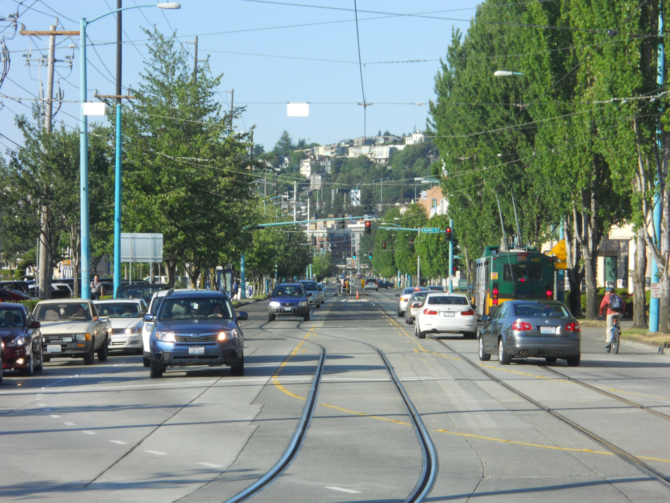
Immediate and tangible change can come from improving streets, the majority of which are owned by local governments. And right-of-way (the technical term for linear-shaped public land) often makes up the largest share of cities’ public land. Seattle, for example, has nearly three times (PDF) as much right-of-way as it does open space, and right-of-way makes up about 27% of the city’s land area; the range of 25-35% is typical of cities that are commonly identified (PDF) as walkable, depending on the street layout and block sizes.
Amid the growing need for multi-modal streets, a common strategy is to implement “road diets” on wide thoroughfares and to convert them”complete streets”. (Note the difference in terminology; roads are commonly considered to be rural or suburban in nature, while streets have a much more urban character.) Such projects slim down the width and number of vehicle lanes, especially if there are more than two per direction, to reduce traffic speeds and increase pedestrian safety. They may also return one-way streets, which encourage speeding and decrease business patronage, to two-way traffic. These measures can contribute to a more pleasant built environment. Bike lanes may be added on major routes while sidewalks are built or expanded. Complete streets should also have transit improvements like bus-only lanes or bulb-outs at stops. (I published a conceptual design for such a project in Seattle.)
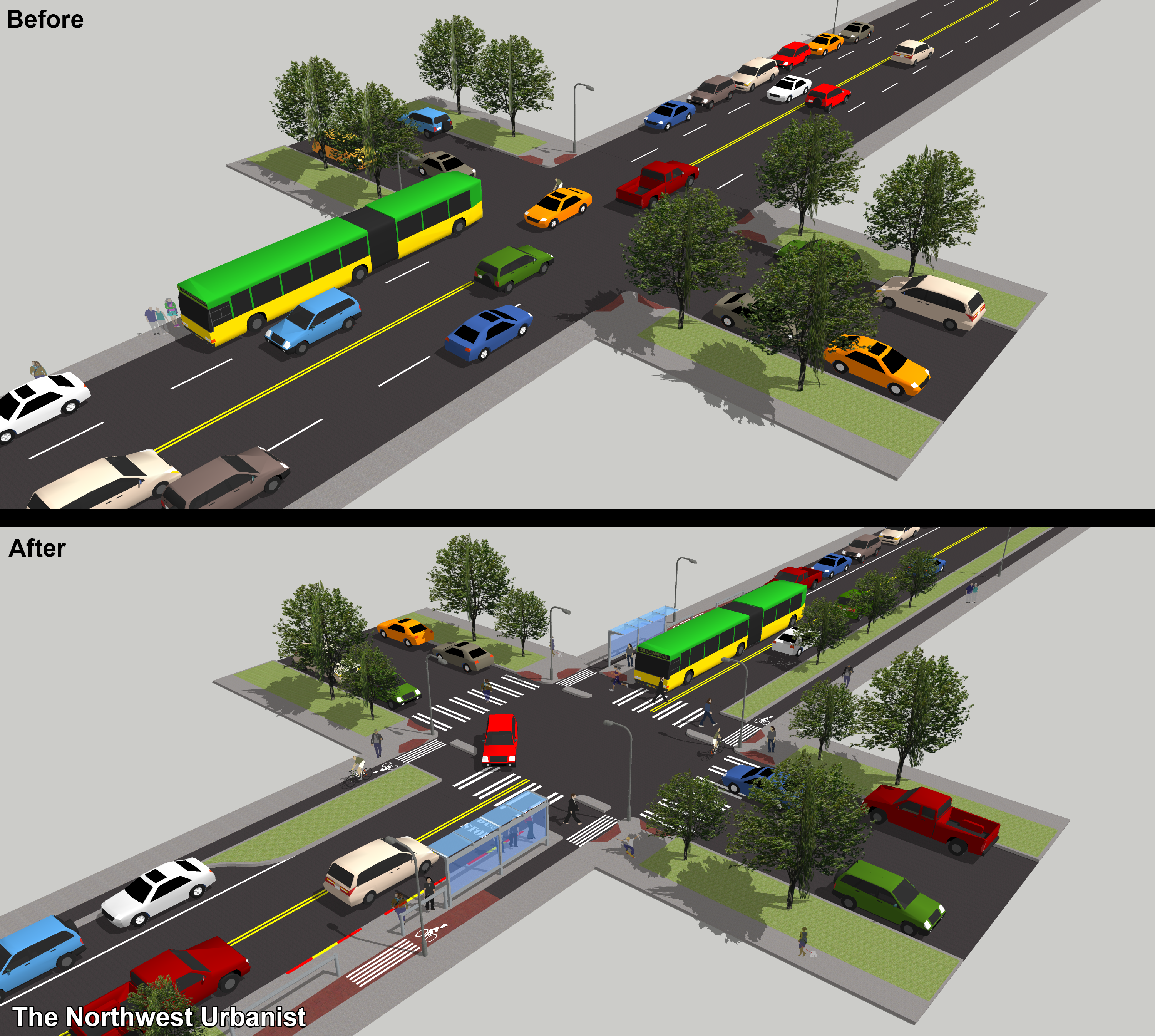
Example of an urban street made “complete”.
Parking can still co-exist and share several purposes: provide curb access to those who need to drive, protect bicyclists and pedestrians from moving traffic, and contribute variety to the “streetscape” (a portmanteau of landscape and street). But on-street parking should be one of the lowest priorities, and it should never be free near popular destinations. Donald Shoup struck a chord with his book, The High Costs of Free Parking, by illustrating that building and maintaining parking facilities is expensive; parking garages, for examples, cost upwards of $30,000-50,000 per space to construct. Free parking encourages driving even when other viable travel options are available, and it greatly decreases availability for those who need it. San Francisco is piloting a promising variable-price parking system that adjusts parking prices based on time of day and available spaces, aiming to maintain one or two open spaces on each block. Seattle is currently readjusting its pricing system in core neighborhoods.

Ravenna Boulevard, part of Seattle’s legacy Olmstead boulevard system.
Trees have had a place on urban streets for centuries and can also fit into complete streets. Often planted on sidewalks and in medians for aesthetic purposes, recent research has quantified the numerous benefits of urban trees. They can provide shade, habitat, stormwater treatment, carbon sequestration, and air filtering, for starters, and their natural beauty supports increased property values, business revenues, and civic pride. Recent developments like flexible pavement and root cells can reduce the damage that trees do to sidewalks, though certain species (PDF) are better suited for street life than others. Tree coverage has been shown to be related to per capita wealth on a city-by-city and even neighborhood level.
What can be done with a street depends greatly on its width. Every inch counts when there are a multitude of competing demands, and it can be easy to follow orthodoxy and still end up with a design that favors the automobile. Streetmix is an online platform that anyone can use to build their own street section, and is a great tool for planners and engineers to initiate public discussion. Most cities have a standard right-of-way width, but there is still great variability. In Seattle, for instance, the right-of-way is commonly 60 feet wide citywide but is usually 100 feet downtown. There are some basic width guidelines to consider for urban streets. Sidewalks should be a minimum of six feet, bike lanes five feet, vehicle lanes ten to eleven feet, and planting strips four feet.
But complete streets should not take a one-size-fits-all approach, instead varying across municipalities based on local traffic patterns, surrounding street grids and land uses, and, most importantly, community priorities. Special conditions for deliveries, utilities, and emergency access should always be considered but be overbearing. In fact it may be advantageous for cities to ditch the standard transportation plan (and its sub-plans for bikes, transit, freight, etc.) and instead create a “master street plan” that takes everything, from plants to people and buses to benches, into account. Then again, focusing on each aspect may allow more focused planning and funding.

Bell Street Park, an example of a shared street. (City of Seattle)
While complete streets are practical in many types of environments, “shared streets” work best in dense urban areas. This concept rides even harder against traditional traffic engineering by relaxing barriers between people and vehicles, attempting to retrieve the mixed-use frenzy of days gone by. A popular influence is the Dutch woonerf, a design that allows users of all modes to share the same space, but strictly limits the speed of cars using curves, bollards, trees, and parking. It’s ideal for side streets in busy commercial districts or dense residential neighborhoods. Seattle’s foremost example, Bell Street Park, was completed this spring between First and Fifth Avenues both to fanfare and criticism.
Shared streets are actually safer than streets designed to move cars quickly, because drivers are forced to move slowly and be highly aware of their surroundings. Naked streets go further by entirely removing signage, traffic lights, and pavement markings, though the benefit this provides for pedestrians and cyclists disappears with large traffic volumes like at one such scheme in Poynton, England. The practice is established or growing in places around the world in places as diverse as Pittsburgh , suburban Chicago, and small town Germany.
If interstate freeways are at one end of the street spectrum, then the pedestrian mall is at the other. This type of street is completely closed off to vehicles and allows the free movement of people. Furniture, plantings, kiosks, and other features are often incorporated to make the street feel more like a public plaza. It’s common practice around the world. New York established one of the most visible and successful examples in December 2013 when, with support from international design firm Snøhetta, it permanently closed part of Times Square to vehicles.
Urban spaces with less than 350,000 visitors a day can still implement this placemaking strategy with ease. Planners can start by selecting a popular street with a row of restaurants, cafes, stores, theaters, or other high-volume attractions and close it off temporarily or partially with plastic bollards, planters, and paint. Throw in some simple tables and chairs and even the most stubborn councilmembers and business owners will be surprised at how many people such an environment will attract. Permanent transformation can be achieved with new pavings, trees, water features, and other elements that are typical of urban plazas. Seattle Bike Blog asks where the city’s next pedestrian plaza should go, with many replies including from an elected official. As part of a post on streetcars I suggested University Way in the U-District, which is already heavily traveled by pedestrians.
As noted earlier, making streets safe and attractive for people also relies upon the adjacent land uses and alternative programming for the street. Integrating residential and commercial uses is essential to giving people a reason to walk or bike on the street in the first place. Short-duration events like street fairs, parades, and farmer’s markets, even on auto-dominated streets, are a proven way to activate the street and draw in large crowds.
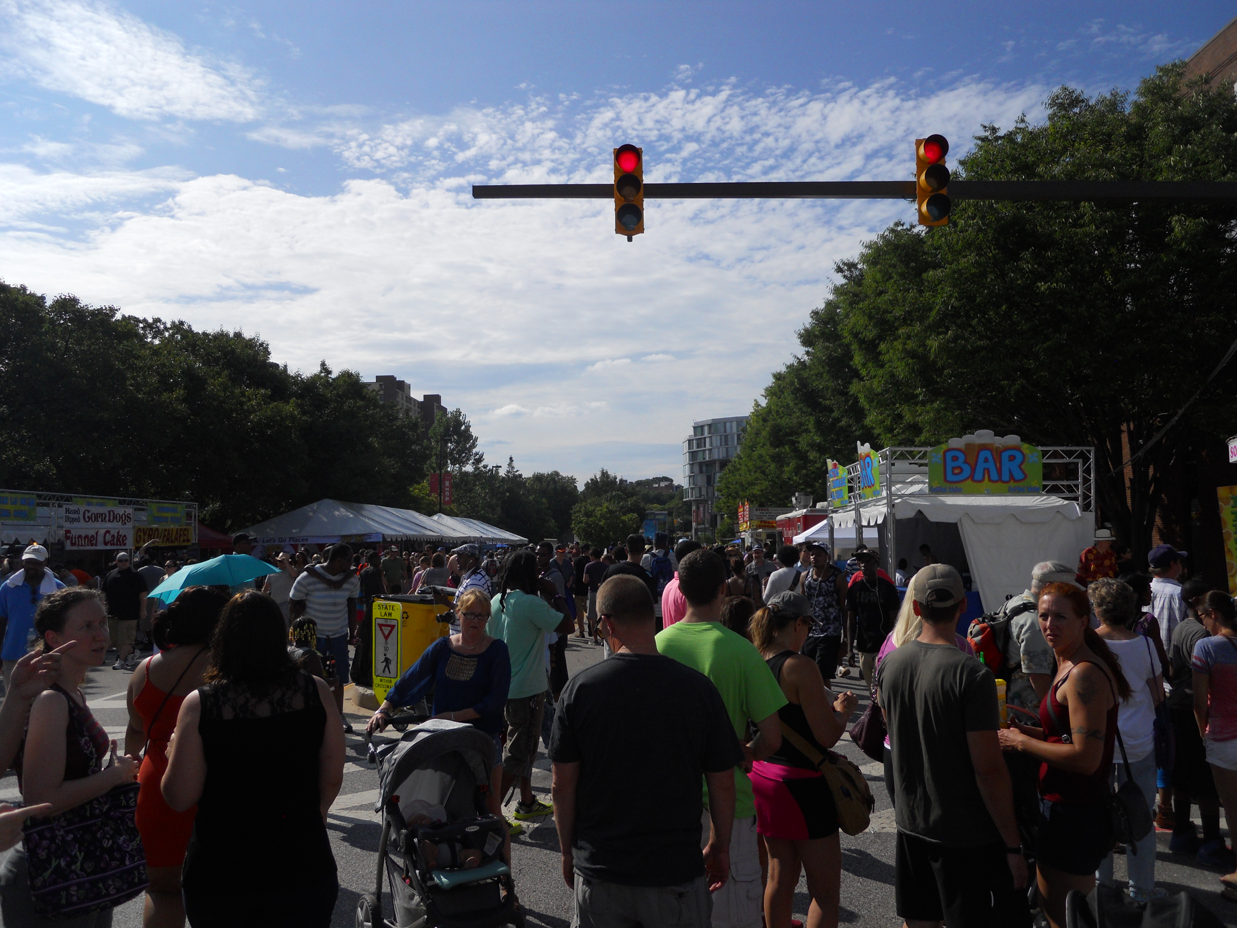
The annual Artscape festival in Baltimore turns 10 city blocks into a pedestrian zone for three days.
A middle ground comes in the form of parklets, which are small parks built (usually) within on-street parking spaces. They can be temporary, with things like chairs and turf grass, or permanent, in which case they are commonly built out of wood in a deck-like fashion. The idea began as a guerrilla art statement in San Francisco ten years ago and is now an annual worldwide event called Park(ing) Day. People are encouraged to build their own temporary parklets to see how street space can be better utilized, usually within the limits of a timed parking meter.
This year, Park(ing) Day falls on September 19th and the City of Seattle plans to officially celebrate by granting formal permission to create one-day parklets. Under a pilot program that works with individual businesses, currently the city has two permanent parklets in Capitol Hill and the International District. Three more are to open on Park(ing) Day: outside City Hostel in Belltown, Cortona Cafe in the Central District, and Urban Visions in Downtown. In addition to these three, ten more in the pipeline will open within the next few months, if not sooner. They each have unique designs attributable to their host neighborhoods and business sponsors.
City streets, suburban boulevards, and small town roads don’t need to be neat and orderly to function at their maximum potential. Good streets can be messy in space, time, and function. And these improvements don’t require great expense to taxpapyers or rock-star designers. The public right-of-way can greatly enhance civic life by moving beyond the notion that streets are primarily for cars, and all it takes to get rolling is a vocal citizenry and visionary leaders.
